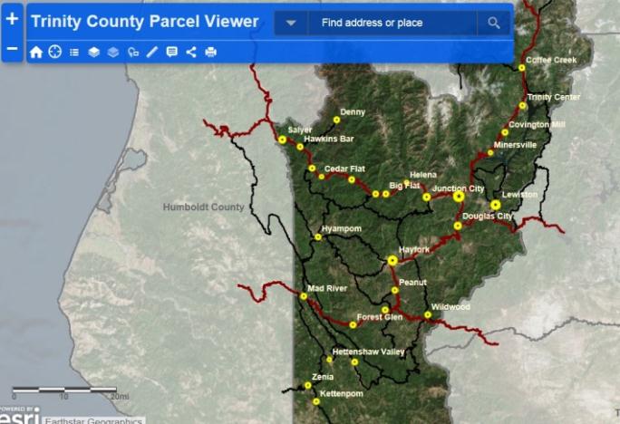
Trinity County Parcel Viewer application is an informational planning tool that allows users to search for an address or parcel number and access basic information about that location, such as physical addressing, lot acreage, zoning and general plan designations, parcels affected by FEMA flood zones, supervisorial district, school district, local fire protection district, water services and sewer services, and electricity provider.
This application was developed in coordination with the County of Trinity and the Trinity County Resource Conservation District with grant funding that was received from Caltrans.
Disclaimer
The County of Trinity makes no guarantee of the quality or completeness of this data. It has not been fully reviewed for accuracy and is intended to be used for planning purposes only. The County assumes no liability or responsibility in the use of this data. While every effort has been made to assure the accuracy of this information, it should be understood that it does not have the force and effect of law, rule, or regulation. In the event of any difference or error, the law will take precedence.
The accuracy of map data varies from location to location in the county. While the GIS is useful for planning purposes, it should not be relied upon to determine property, zoning or general plan designation boundaries or be used in any way for project design. All GIS data should be verified before it is materially relied upon for property or project planning. In urban areas the GIS map data may be inaccurate by as much as 50 feet in any direction. In rural areas the map data may be inaccurate by as much as 400 feet in any direction.
> Trinity County Parcel Viewer Application